Marmara, Infrastructure description
- Date of Deployment: April 2011
- Location: Sea of Marmara
- Type: Autonomous instruments
- Distance from land: 20 km
- Maximal depth: 1200 m
|
Geodetic Network
| - Coordinates: 40.870°N 28.524°E
- Short description: Geodetic network of 4+6 acoustic ranging beacons deployed in collaboration with GEOMAR (Kiel, Germany) in Nov 2014.
| - Acoustic travel time
- Temperature
- Pressure
- P-wave velocity
|
Bottom Pressure Recorder
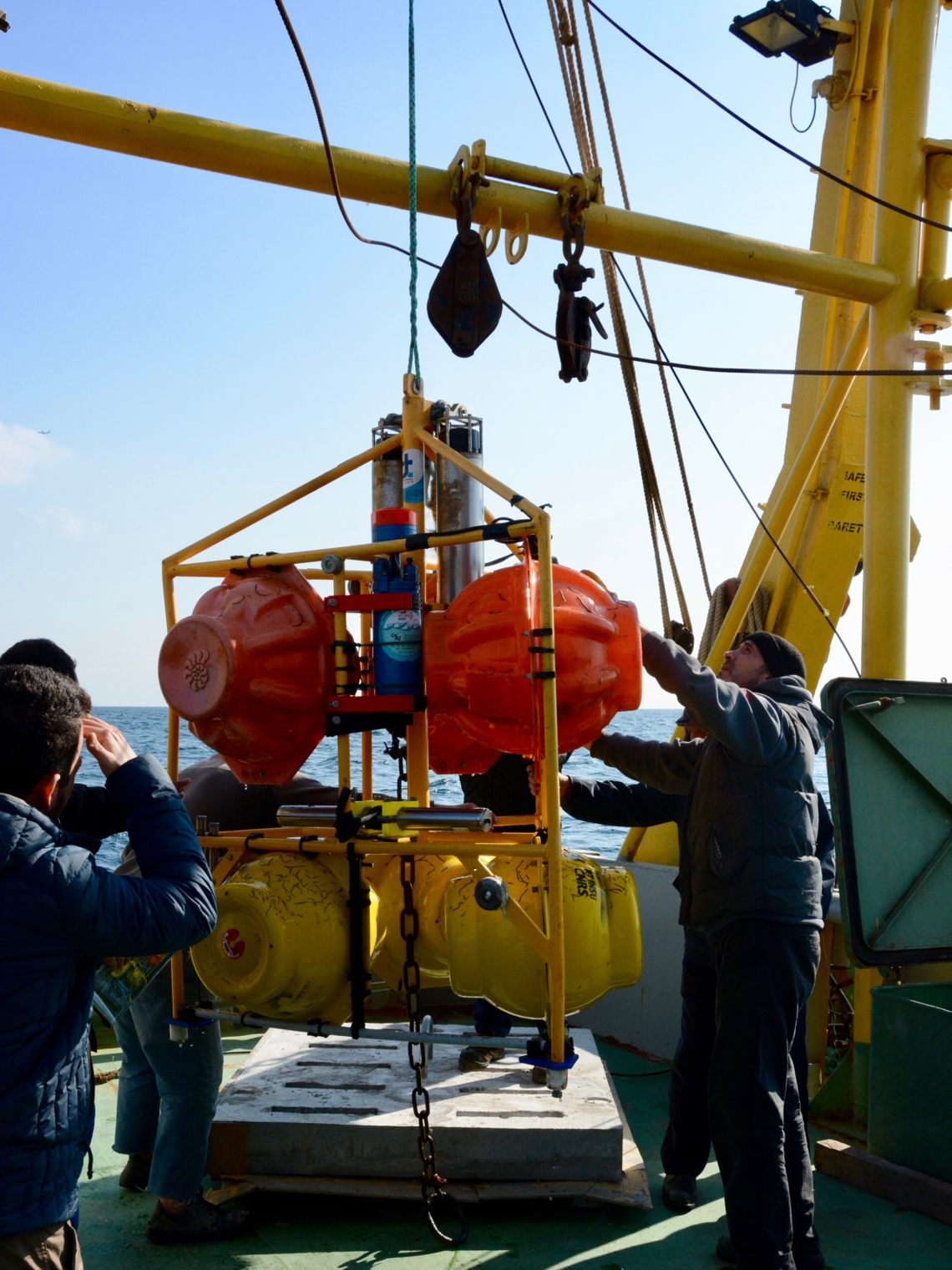 © Ta Palagro © Ta Palagro
| - Location: Different locations
- Short description: Instrumented frame deployed since January 2018 at a different location every 6 month in order to record and map the resonant modes (seiches, internal waves) of the water body.
| - Absolute Pressure
- Temperature
- Current
- Conductivity
- Dissolved O2
|
Ocean Broadband Seismometers
| - Location: Western High and Kumburgaz Basin
- Short description: Ocean Bottom Seismometer networks were deployed April-Nov 2011 and Sept-Nov 2014 on the Western High and Oct 2014-April 2016 in Kumburgaz Basin at the geodetic network site (collaboration with GEOMAR).
| |
Data policy and access
- Periodically recovered data: Free access, previous year data treated by the quality assurance process, yearly recovery, download through doi
|
Maintenance
Contacts
- PI: Pierre Henry1, Louis Geli2, Sinan Özeren3
- Primary contact: Pierre Henry1
- Data management contact: Maurice Libes4
- Maintenance contact (Technical supervisor): Emmanuel de Saint-Léger5
|
1: Aix Marseille Univ, CNRS, IRD, INRAE, Coll France, CEREGE, Aix-en-Provence, France
2: Ifremer, France
3: Istanbul Technical University, Eurasia Institute of Earth Sciences, Maslak, Istanbul, Turkey
4: CNRS, OSU Pytheas, Aix Marseille Univ.
5: CNRS, DT INSU, Plouzané

