EMSO-Azores Infrastructure description

  • Date of Deployment: 29 July 2010
  • Location: South of Azores, Lucky Strike
  • Type: Non cabled observatory
  • Distance from land: 200 nautical miles WSW from Faial
  • Maximal depth: 1700 m
Transmission buoy, BOREL

  • Coordinates:  37.5 °N  and  33.00 °W
  • Short description: Borel is the surface buoy, relaying bi-directionally measurement data or commands between seabed and shore, through underwater acoustics and satellite. Borel holds a geodetic Global Positioning System and can host near surface ocean sensors.
SeaMoN West

  • Coordinates: 37.291 °N   and  32.279 °W
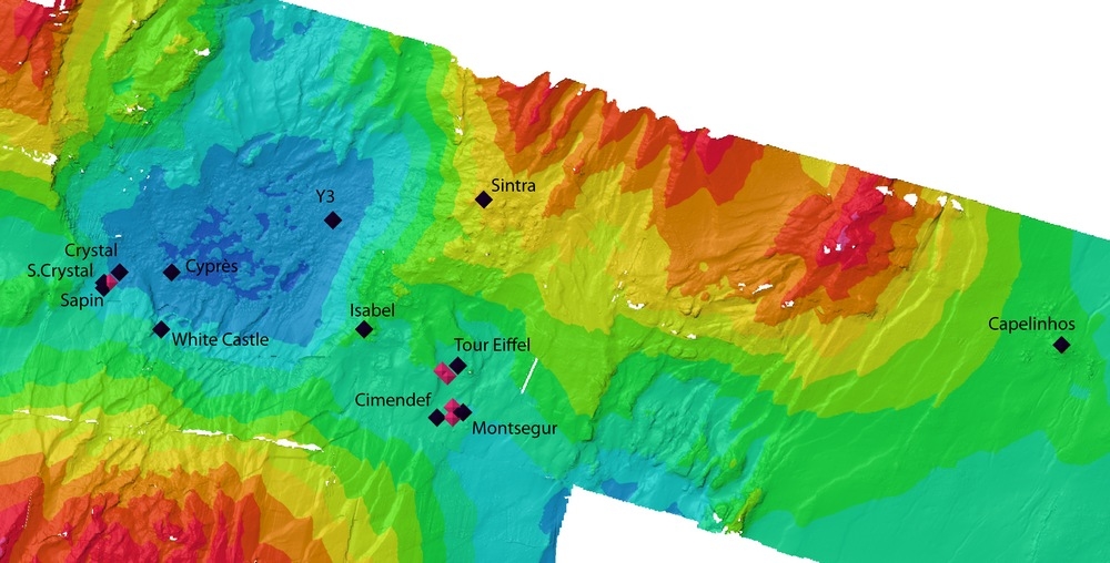
  • Short description: SeaMoN West is the station moored in the lava lake. It serves the local set of sensors and provides bi-directional acoustic communication with the surface buoy. SeaMoN West is dedicated to geophysical observations.
SeaMoN East

  • Coordinates: 37.29 °N  and  32.27 °W
  • Short description: SeaMoN East is the station positionned at the base of the Tour Eiffel active edifice. It serves the local set of sensors and provides bi-directional acoustic communication with the surface buoy. SeaMoN East is the EMSO-Azores ecological node.
Autonomous devices

Data policy and access

  • Near real time transmitted data: Free access, no quality check, counter of the number of consultation, 4 transmission per day, download through DOI
  • Periodically recovered data: Free access, previous year data treated by the quality assurance process, yearly recovery, download through DOI
Maintenance

  • Maintenance frequency: 12 months
  • Duration of operations: 20 days
  • Services available: Cruise preparation, lab compatibility tests, implementation on site, data transmission, archiving and dissemination

Read more about the cruises...

Contacts
  • PI: Mathilde Cannat1, Pierre Marie Sarradin2
  • Primary contact: Jerome Blandin2
  • Data management contact: Thierry Carval2
  • Maintenance contact (Technical supervisor): Julien Legrand2

1 : CNRS IPGP, France
2 : Ifremer, France