Marmara, Maintenance cruises
MARMARA Workshop, 7th to 9th September 2022, Marseille (France)
The workshop broached the monitoring projects in the Sea of Marmara with the objective to propose a roadmap for future activities in the EMSO ERIC framework and to open the Marmara site to new scientific objectives, notably in oceanography, and to new or recently developed monitoring methods. |
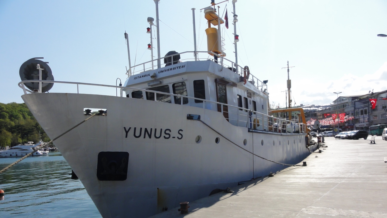
Yunus, 28th November 2020
The objective of this cruise was to the final recovery, from Imrali Basin of an instrumented frame deployed during a previous Istanbul University RV Yunus-S cruise, Nov 19-20, 2019. Because of COVID-19 restrictions, the cruise, initially planned in May 2020 was delayed until November The frame was successfully recovered but instruments were out of battery power. Learn more... Özeren Sinan, Henry Pierre, Yakupog?lu Nurettin (2020). RV YUNUS-S (Istanbul University) cruise report. November 28, 2020 Istanbul - Istanbul. MAREGAMI Project (ANR-16-CE03-0010-02 and Tübitak 116Y371). https://doi.org/10.13155/78821 |
Yunus, 19th and 20th November 2019
Recovery, servicing and fourth deployment of the BPR instrumented frame with RV Yunus-S. The BPR frame was equipped with a bottom pressure recorder and a recording current meter with oxygen probes. Both devices provided time series for the whole deployment period, but the salinity probe was faulty. Data include a record of the Sept 26, 2019 M5.8 Silivri earthquake and of a turbidity current triggered by this event. Learn more... Pierre Henry, Sinan Özeren, Ziyadin Çakir, Nurettin Yakupoğlu, Olivier Desprez de Gésincourt, Nov. 2019, RV Yunus-S (Istanbul University) cruise report https://doi.org/10.13155/74226 |
Yunus, 8th and 9th May 2019
Recovery, servicing and third deployment of the BPR instrumented frame with RV Yunus-S. The bottom pressure recorder provided 6 months of data but the recording current meter (RCM) experienced a battery failure after just one month. A new oxygen probe was refit on RCM in addition to the salinity, pressure and temperature probes. Learn more... Pierre Henry, Sinan Özeren, Nurettin Yakupoğlu, Olivier Desprez de Gésincourt, Christos Papoutselis, May 2019, RV Yunus-S (Istanbul University) cruise report https://doi.org/10.13155/74225 |
Yunus, 12th and 13th November 2018
| Recovery, servicing and second deployment of the BPR instrumented frame with RV Yunus-S. The bottom pressure recorder provided 6 months of data but the recording current meter (RCM) had failed because of a leak on the oxygen optode. The RCM was repaired and redeployed with salinity, pressure and temperature probes. Learn more... Pierre Henry, Sinan Özeren, Nurettin Yakupoğlu, Olivier Desprez de Gésincourt, Nov. 2018, RV Yunus-S (Istanbul University) cruise report https://doi.org/10.13155/74224 |

Yunus, 29th and 30th January 2018
During this cruise of RV Yunus-S, a last acoustic ranging data set was downloaded. Only 3 of the transponders responded and their batteries were almost exhausted. Two of the IUEM transponders were retrieved from the seafloor. The other 8 transponders will be recovered with an ROV. The first of a series of deployments of the BPR instrumented frame was also done. The BPR frame was equipped with a bottom pressure recorder and a recording current meter with salinity, pressure, temperature and salinity probes. Learn more... Pierre Henry, Nurettin Yakupoğlu, Dietrich Lange, Jan. 2018, Operations on board Istanbul University RV Yunus-S https://doi.org/10.13155/74228 |
Yunus, 4th and 5th May 2017
| The objective of the cruise was to download data from the sea-bottom acoustic ranging beacons in the Kumburgaz Basin, Marmara Sea that were installed during Marsitecruise in Oct-Nov 2014. This cruise was organized by the Technical University of Istanbul (ITU) using Istanbul University RV Yunus-S. 9 out of 10 beacons responded and transmitted one more year of data. In May 2017, the stations had been recording for 2 years and 4 months. Learn more... Jean-Yves Royer, Ziyadin Çakir, Dietrich Lange, Pierre Henry, May 2017, SEAFLOOR GEODESY MARMARA - RV Yunus-S CRUISE https://doi.org/10.13155/74227 |
PRV POSEIDON Cruise Report POS497, 12th to 15 th April 2016
In April 2016, a third set of acoustic ranging data, spanning one more year, was downloaded from the seafloor transponders. 9 out of 10 beacons responded. Learn more... Lange, Dietrich (2016) RV Poseidon Cruise Report POS497: Seafloor acoustic ranging across the North Anatolian Fault offshore Istanbul, Çanakkale – Izmir, (12.4 – 15.4.2016). GEOMAR Helmholtz Centre for Ocean Research, Kiel, 13 pp. http://dx.doi.org/10.3289/CR_POS_497 |
POSEIDON No. 484, leg 1 [POS484/1], 24th April to 27th April. 2015
In April 2015, a second set of acoustic ranging data, spanning a period of 6 months, was downloaded from the seafloor transponders using a modem from the sea surface. All 10 beacons responded and data was retrieved successfully. Learn more... Lange, Dietrich and Kopp, Heidrun (2015) Final Cruise Report Poseidon No. 484, leg 1 [POS484/1], 24th April – 27th April., 2015, Izmir – Canakkale (Turkey). . UNSPECIFIED, 10 pp. http://dx.doi.org/10.3289/CR_POS_484/1 |
MARSITE cruise, 29th October 2014 to 16th November of 2014
The cruise objective was to better understand the behaviour of the submerged section of the North Anatolian fault in the Marmara Sea. 10 acoustic ranging beacons provided by IUEM (Brest, France) and GEOMAR (Kiel, Germany) were deployed on the seabed to measure displacements across the Main Marmara Fault south of Istanbul. The ROV VICTOR-6000 was deployed for sampling (interstitial waters, gas, brines) and in situ measurements aiming to understand the processes of fluid migration along faults. Lastly, an acoustic bubble detector (BOB), two ocean-bottom seismometers and an acoustic Doppler current profiler (ADCP) were deployed by the ROV, to study the natural methane degassing phenomenon at the sea floor. The third part of the cruise was to acquire sediment cores, recover these instruments. A first set of acoustic ranging data, acquired by the seafloor beacons for the duration of the cruise, was downloaded at the end through an acoustic modem for control. Learn more... Geli Louis, Ruffine Livio, HENRY Pierre (2014) MARSITECRUISE cruise, RV Pourquoi pas ?, https://doi.org/10.17600/14000500 Geli Louis, Ruffine Livio, Henry Pierre (2014). MarsiteCruise. R/V Pourquoi Pas? October 28 - November 16, 2014. Six months Report. Volume 1: General foreword & Report of instrument deployment and recovery operations during Legs 1, 2 & 3. https://doi.org/10.13155/56477 Ruffine Livio, Geli Louis (2014). MARSITECruise Report. 2014 1st ‐ 13th November ‐ Leg 2. https://doi.org/10.13155/56480 Henry Pierre, Kende Julia (2015). MARSITECRUISE R/V Pourquoi pas? October 28th – November 17th, 2014. Leg 3 - Six-Month Cruise Report. https://doi.org/10.13155/54534 |
MARMESONET URANIA, 2011
|

MARMESONET LE SUROIT, 2009
| The MARMESONET cruise of RV Le Suroît was part of the Marmara Demonstration Mission Program supported by ESONET Network of Excellence (European Seafloor Observatory Network), within the 6th European Framework Program. Main partners were: Ifremer, CNRS/CEREGE, Istanbul Technical University, TUBITAK, Institute of Marine Science and Technology of Dokuz Eylül Universitesi (Izmir), INGV (Rom) and ISMAR (Bologna). Marmesonet was also the follow-on of the Franco-Turk collaborative program that resulted in numerous cruises in the Sea of Marmara since 2000. Learn more... Press release, 3rd of novembre 2009 and the video presented during the press conference GELI Louis, HENRY Pierre (2009) MARMESONET cruise, RV Le Suroît, https://doi.org/10.17600/9020040 Geli Louis, Henry Pierre, Cagatay M Namik, L'Équipe Scientifique Marmesonet Leg 1 (2010). Marmesonet Cruise. RV Le Suroit. Leg1. https://archimer.ifremer.fr/doc/00398/50963/ |

MARNAUT, 2007
| MARNAUT was a cruise of RV L'Atalante with manned submersible Nautile. Its objectives were centered on the relationships between active faults, fluid emissions, and landslides. MARNAUT was also a step toward the development of permanent seafloor observatories on the North Anatolian Fault in the Sea of Marmara, within the European framework of the ESONET Network of Excellence. MARNAUT involved French institutions (CNRS/INSU, Ifremer and College de France), Turkish partner institutions (ITU, Istanbul Technical University and MTA, Maden Tetkikve Arama, Ankara), SIO (Scripps Institution of Oceanography, San Diego, USA), ISMAR (Istituto di Scienze Marine, Bologna, Italy), Berlin Free University, and Geomar (Germany). Learn more... (2007) MARNAUT cruise (Fluid and seismicity along the Main Marmara Fault), L’Atalante and SV Nautile, https://doi.org/10.17600/7010070 Henry Pierre, Sengor A.M. Celâl, Cagatay M. Namik, L'Équipe Scientifique Marnaut (2007). Marnaut cruise report. https://archimer.ifremer.fr/doc/00398/50967/ |
